


ID Antelope Land Ownership.
The Land Ownership Maps are built using land ownership data from USGS, National Forest and the State. We add current location data, streams, lakes, roads and trails from the USGS 7.5 minute Quad Map data set then print it on our rugged map fabric to create the best map in the industry. Click on the small map at left to see a larger sample. Scroll to the bottom of the map to order then move to the bottom right to Add To Cart.
Select options
This product has multiple variants. The options may be chosen on the product page
Idaho Bear Land Ownership Maps.
The Land Ownership Maps are built using land ownership data from USGS, National Forest and the State. We add current location data, streams, lakes, roads and trails from the USGS 7.5 minute Quad Map data set then print it on our rugged map fabric to create the best map in the industry. Click on the small map at left to see a larger sample. Scroll to the bottom of the map to order then move to the bottom right to Add To Cart.
Select options
This product has multiple variants. The options may be chosen on the product page
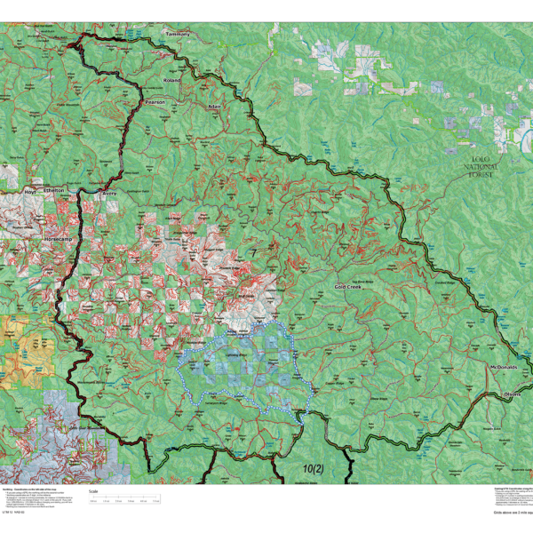
Idaho Bighorn Sheep Unit Maps
The Land Ownership Maps are built using land ownership data from USGS, National Forest and the State. We add current location data, streams, lakes, roads and trails from the USGS 7.5 minute Quad Map data set then print it on our rugged map fabric to create the best map in the industry. Click on the small map at left to see a larger sample. Scroll to the bottom of the map to order then move to the bottom right to Add To Cart.
Select options
This product has multiple variants. The options may be chosen on the product page
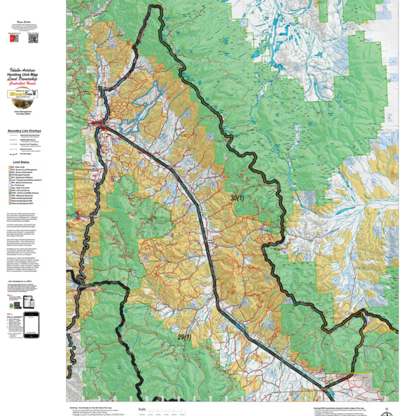
Idaho Elk Controlled Hunt Maps.
The Land Ownership Maps are built using land ownership data from USGS, National Forest and the State. We add current location data, streams, lakes, roads and trails from the USGS 7.5 minute Quad Map data set then print it on our rugged map fabric to create the best map in the industry. Other maps you see online are created from scanned BLM maps. The scanned maps from the BLM area great but many are 5 or more years old. Our maps are built from the ground up with current data. We use several different software programs to handle the complexity and publication of these maps. These maps are printed on our rugged map fabric to create a map that will last as long as your memories! Choose a unit below then move to the bottom right and click ADD to CART to order your map.
Select options
This product has multiple variants. The options may be chosen on the product page
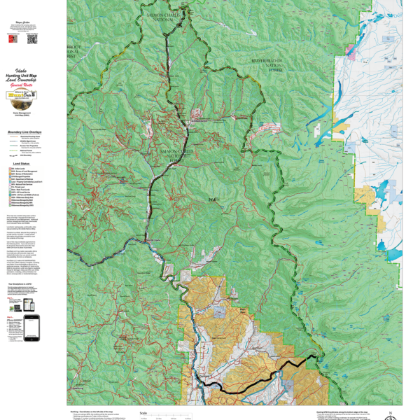
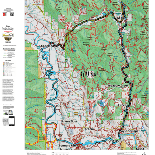
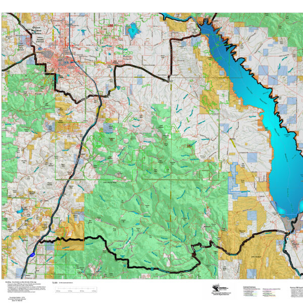
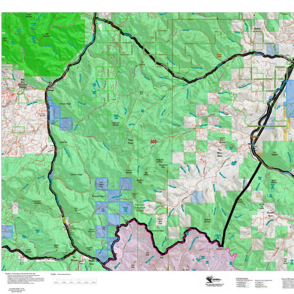
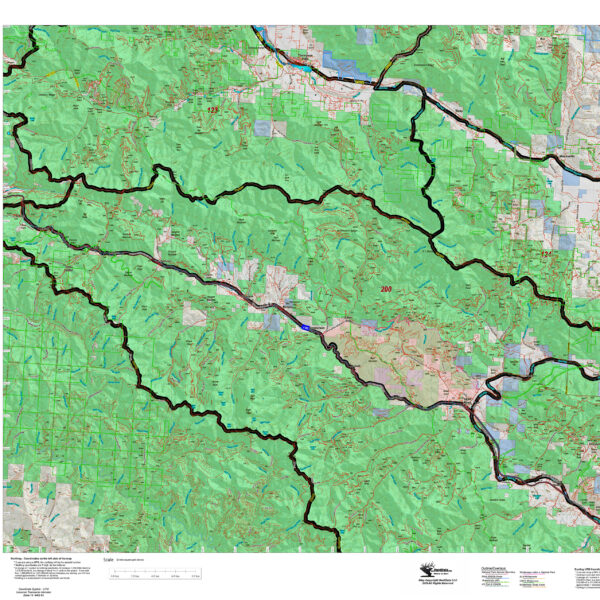
Idaho General Land Ownership Hunting Unit Maps.
The Land Ownership Maps are built using land ownership data from USGS, National Forest and the State. We add current location data, streams, lakes, roads and trails from the USGS 7.5 minute Quad Map data set then print it on our rugged map fabric to create the best map in the industry. Click on the small map at left to see a larger sample. Scroll to the bottom of the map to order then move to the bottom right to Add To Cart.
Select options
This product has multiple variants. The options may be chosen on the product page
Idaho Moose Unit Maps.
The Land Ownership Maps are built using land ownership data from USGS, National Forest and the State. We add current location data, streams, lakes, roads and trails from the USGS 7.5 minute Quad Map data set then print it on our rugged map fabric to create the best map in the industry. Click on the small map at left to see a larger sample. Scroll to the bottom of the map to order then move to the bottom right to Add To Cart.
Select options
This product has multiple variants. The options may be chosen on the product page
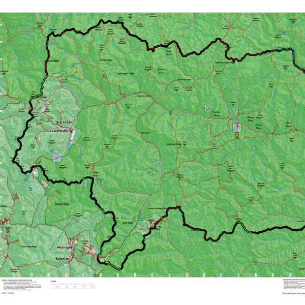
Idaho Mountain Goat Unit Maps.
The Land Ownership Maps are built using land ownership data from USGS, National Forest and the State. We add current location data, streams, lakes, roads and trails from the USGS 7.5 minute Quad Map data set then print it on our rugged map fabric to create the best map in the industry. Click on the small map at left to see a larger sample. Scroll to the bottom of the map to order then move to the bottom right to Add To Cart.
Select options
This product has multiple variants. The options may be chosen on the product page
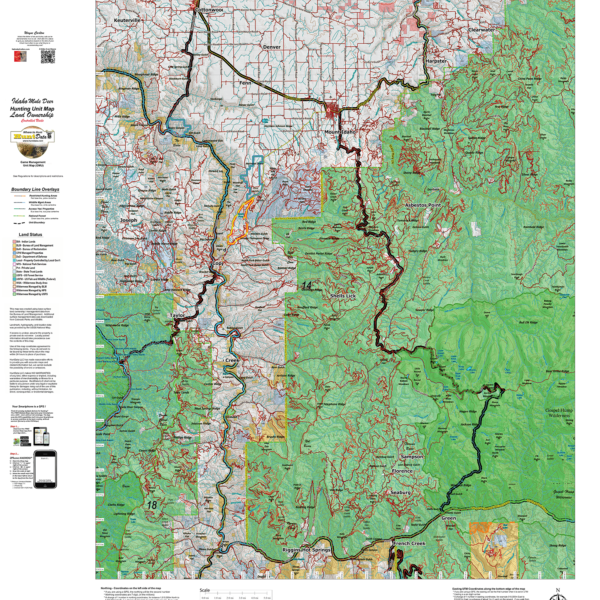
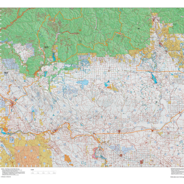
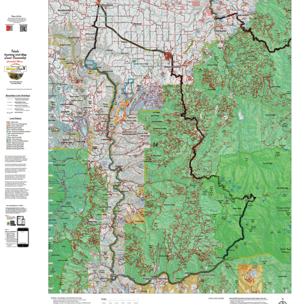
Idaho Mule Deer Land Ownership Maps for Controlled Hunts.
The Land Ownership Maps are built using land ownership data from USGS, National Forest and the State. We add current location data, streams, lakes, roads and trails from the USGS 7.5 minute Quad Map data set then print it on our rugged map fabric to create the best map in the industry. Click on the small map at left to see a larger sample. Scroll to the bottom of the map to order then move to the bottom right to Add To Cart.
Select options
This product has multiple variants. The options may be chosen on the product page
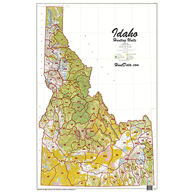
Idaho Statewide BLM BigGame General Unit Map with Land Status
Statewide 1:500,000 Land Ownership Map displaying the general unit boundaries. BLM, National Forest, State and private lands color coded to give give you an idea of the public lands available for your hunt! The map is printed on our rugged material to last for years. Hang it in the den or at the office to spawn plans and feed hunting dreams!
Montana Antelope District Land Ownership Maps
Custom maps built from the ground up using the latest BLM Land Status information, USGS 7.5 minute roads, National Forest, State, and other land ownership information with the latest Bighorn Sheep District boundary and portion (restrictions or closed) highlights. All printed on our rugged map fabric to creating a vibrant, long-lasting map.
Select options
This product has multiple variants. The options may be chosen on the product page
Montana Bighorn Sheep District Land Ownership Maps
Custom maps built from the ground up using the latest BLM Land Status information, USGS 7.5 minute roads, National Forest, State, and other land ownership information with the latest Bighorn Sheep District boundary and portion (restrictions or closed) highlights. All printed on our rugged map fabric to creating a vibrant, long-lasting map.
Select options
This product has multiple variants. The options may be chosen on the product page
Montana Elk District Land Ownership Maps
Custom maps built from the ground up using the latest BLM Land Status information, USGS 7.5 minute roads, National Forest, State, and other land ownership information with the latest Bighorn Sheep District boundary and portion (restrictions or closed) highlights. All printed on our rugged map fabric to creating a vibrant, long-lasting map.
Select options
This product has multiple variants. The options may be chosen on the product page