


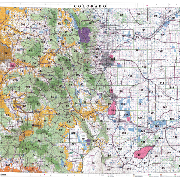
Colorado Statewide BLM BigGame Unit Map with Land Status.
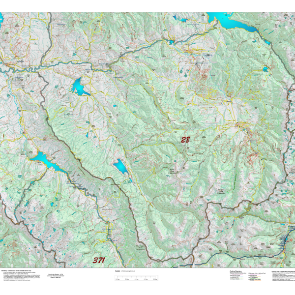
Colorado Topographical Maps
We re-designed our base topo maps matching projection to unit size and added enhanced USGS 7.5 minute road and trail overlays. The result is complete unit coverage with most detailed roads and trail systems available.
Select options
This product has multiple variants. The options may be chosen on the product page
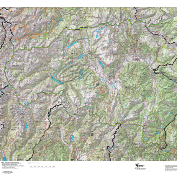
Colorado Topographical Maps 19.95 to 29.95
Out Topo maps are unique. We scale the map to ensure the entire unit is included then, generate the topo data including the roads and trails from the USGS 7.5 minute Quad series. The result is the most detailed roads and trails available for your unit.
Select options
This product has multiple variants. The options may be chosen on the product page
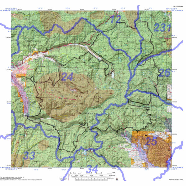
Colorado Wilderness Hunting Maps.
1:100,000 scale maps for Colorado's Wilderness areas. Each map displays Wilderness Boundaries as well as Unit (GMU) boundaries. The maps are printed on waterproof, tear resistant paper. Choose just the GMU boundaries or add the elk concentration data as well.
Select options
This product has multiple variants. The options may be chosen on the product page
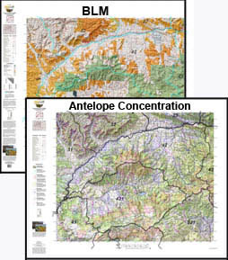
Custom Antelope Combo – Land Ownership and Concentration Maps.
Buy the tools needed to find out where you CAN hunt and where you SHOULD hunt. Use our concentration maps to pinpoint the public lands then identify whether the concentrations are on the public land. Its all about "Where to Hunt". The maps are printed on our tear and water resistant fabric materials that will last as long s your memories.
Select options
This product has multiple variants. The options may be chosen on the product page
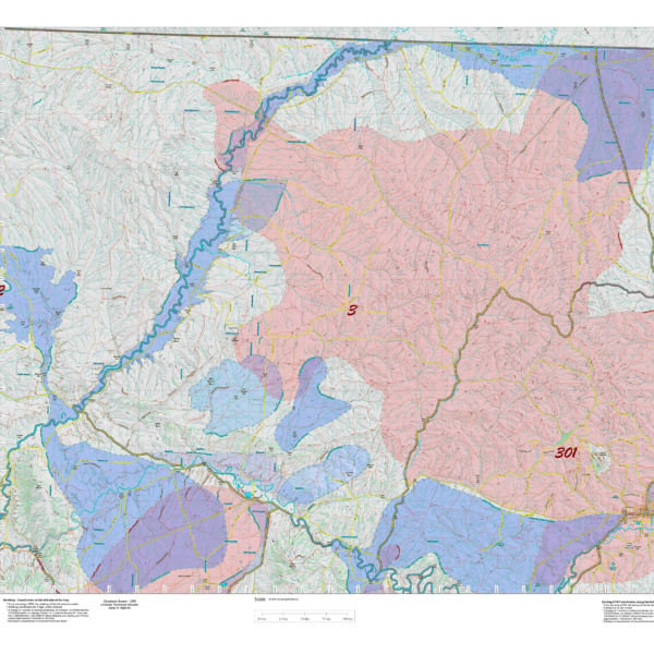
Custom Antelope Concentration Maps
Antelop Concentration Maps were invented by HuntData. These maps have been our best sellers over the past 25 years. This year, we updated the styles, enhancing boundaries, clarifying summer, winter, and resident herds, migration routes and adding 7.5 minute roads from the USGS Quad collection. Click on the small map at left to see a larger sample. Then, scroll to the bottom to read more and order. This map will help put you in the right place for success! Its printed on our rugged map fabric designed to last as long as your hunting memory.
Select options
This product has multiple variants. The options may be chosen on the product page
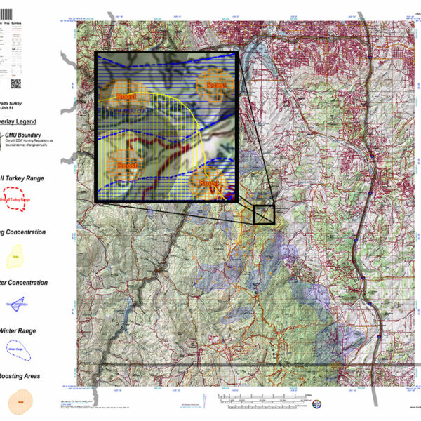
Custom Colorado Turkey Maps
Select options
This product has multiple variants. The options may be chosen on the product page
Custom Colorado Whitetail Deer Concentration Maps.
Select options
This product has multiple variants. The options may be chosen on the product page
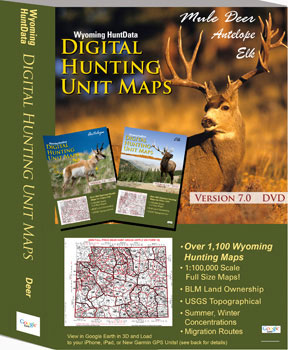
Digital Maps – Wyoming State Map Set.
A first of its kind. The Statewide Wyoming Map set consists of over 1,100 maps. This includes 3 maps for every Antelope Unit. A Topo map with boundaries, a Land Ownership Map from the BLM, and a first of its kind - a habitat map showing summer range, winter range, and migration routs. View these maps on your desktop or go mobile and load them to your iPhone, iPad, or DROID. A must-have for serious hunters.
Select options
This product has multiple variants. The options may be chosen on the product page
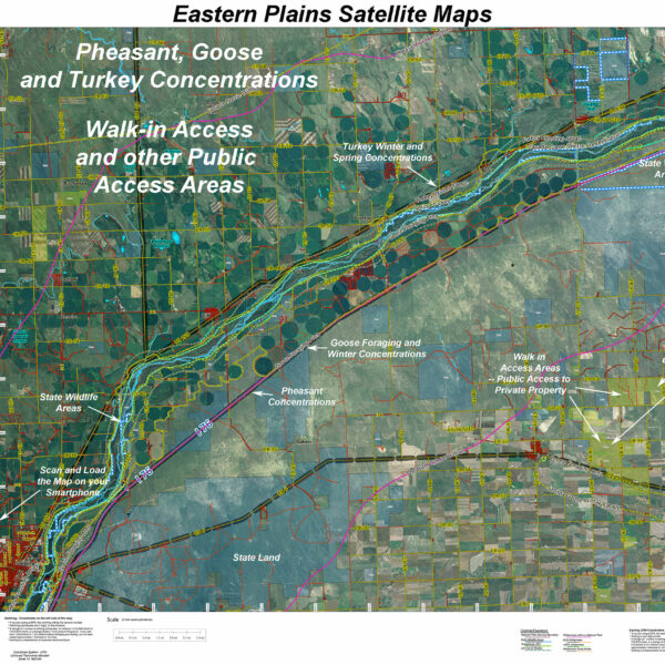
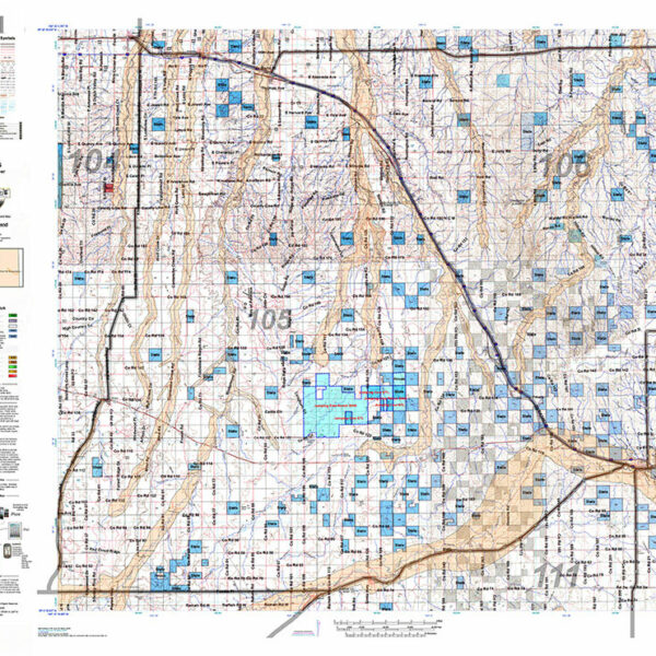
Eastern Plains Land Ownership Unit Maps
The Eastern Plains Digital Maps display private land State Lands and Colorado Parks and Wildlife managed properties. These properties are critical as they off public hunting access.
Select options
This product has multiple variants. The options may be chosen on the product page
Hybrid! UT Mule Deer Land Ownership AND habitat on one map.
Our Hybrid Maps are built with land ownership data then we project Summer, Fall, and Winter Concentration data to create a map showing you not only where you CAN hunt, but where you SHOULD hunt as well! Click on the small map at left to see a larger sample then Scroll to the bottom of the map to order then move to the bottom right to Add To Cart.We also add the USGS roads and trails from their 7.5minute Quad Maps. We use 5 different software programs to handle the complexity and publication of these maps. The Hybrid maps are printed on our rugged map fabric to create a map that will last as long as your memories!
Select options
This product has multiple variants. The options may be chosen on the product page
Hybrid! Utah Elk Land Ownership and Habitat Hybrid Map.
Our Hybrid Maps are built with land ownership data then we project Summer, Fall, and Winter Concentration data to create a map showing you not only where you CAN hunt, but where you SHOULD hunt as well! Click on the small map at left to see a larger sample then Scroll to the bottom of the map to order then move to the bottom right to Add To Cart.We also add the USGS roads and trails from their 7.5minute Quad Maps. We use 5 different software programs to handle the complexity and publication of these maps. The Hybrid maps are printed on our rugged map fabric to create a map that will last as long as your memories!
Select options
This product has multiple variants. The options may be chosen on the product page