


Wyoming Black Bear Land Ownership.
Select options
This product has multiple variants. The options may be chosen on the product page
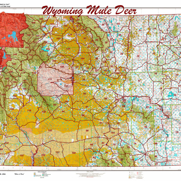
Printed Wyoming Statewide Mule Deer Unit Map.
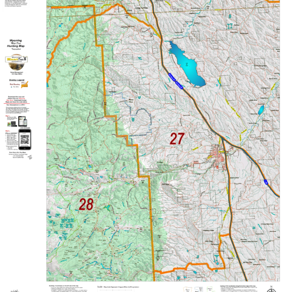
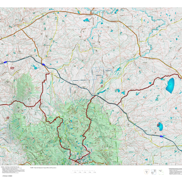
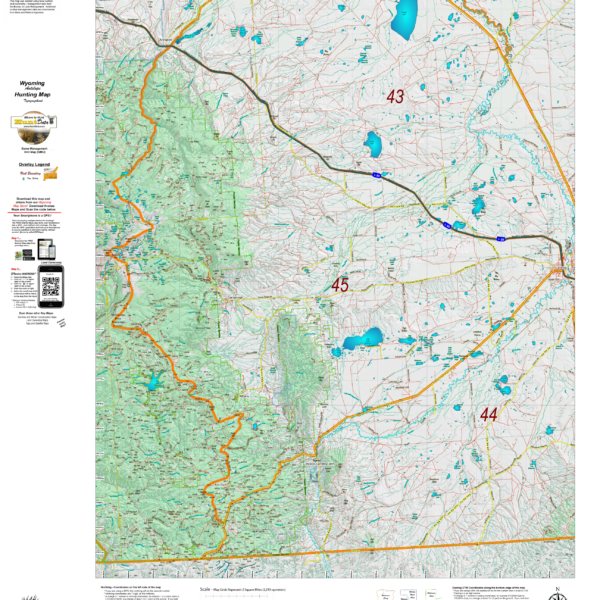
Wyoming Mule Deer Topograhical Maps.
We rebuilt the entire Topo line. We've updated the roads and trails USGS 7.5 minute Quad series. US Forest Boundaries and State Lands are newly updated and highlights. A great traditional Topo map with enhancements. Click Here to see the Wyoming Deer GMU Reference Map.
Select options
This product has multiple variants. The options may be chosen on the product page
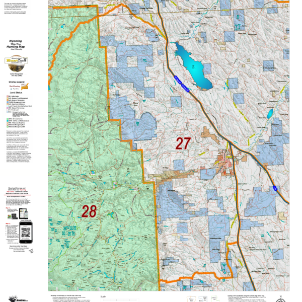
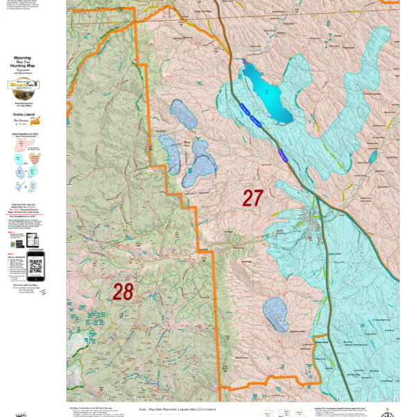
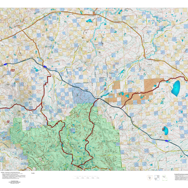
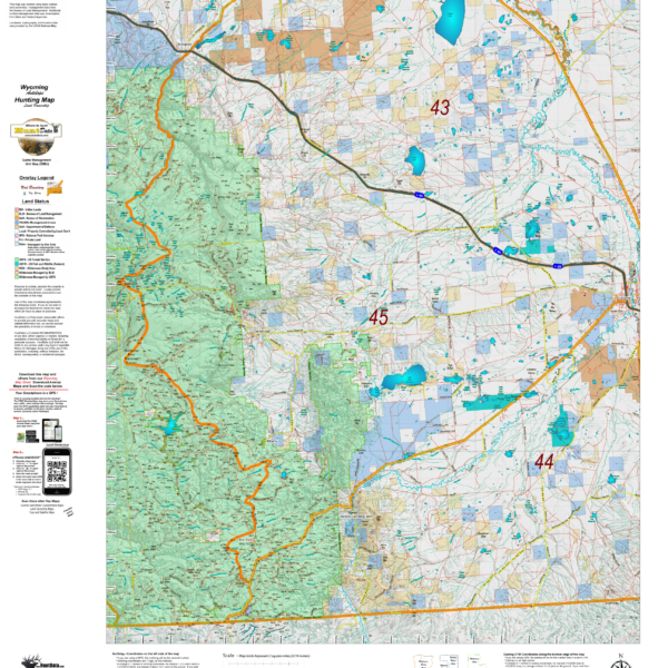
Wyoming Mule Deer Land Ownership Maps.
We took new land ownership data and built these maps from the bottom up. The maps include the USGS roads and trails from their 7.5min Quad Series. The maps are printed on our new rugged map fabric. A great tool to find out where you can hunt. Click Here to see the Wyoming Deer GMU Reference Map.
Select options
This product has multiple variants. The options may be chosen on the product page
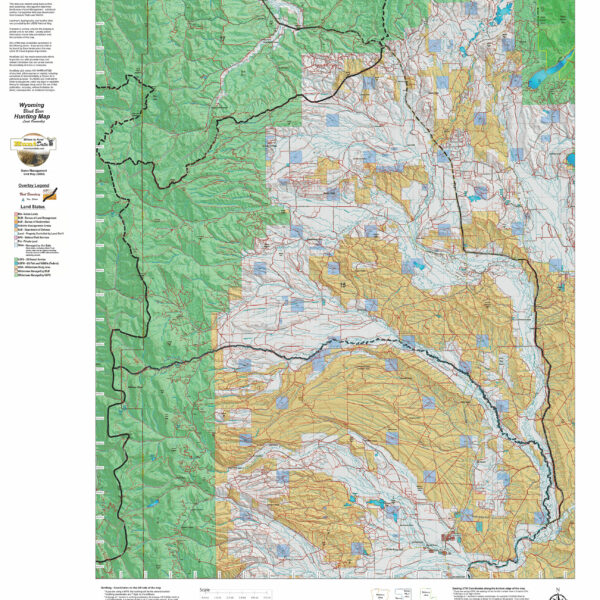
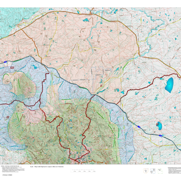
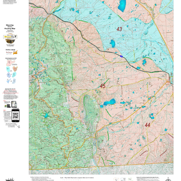
Wyoming Mule Deer Habitat Map.
We updated our Topo Maps then added new habitat overlays. The overlays display Summer and Winter Concentration areas in brilliant colors. As with all of our custom maps, these maps are printed on our rugged map fabric. Click Here to see the Wyoming Deer GMU Reference Map.
Select options
This product has multiple variants. The options may be chosen on the product page
Wyoming Elk Topographical Map.
We rebuilt the entire Topo line. We've updated the roads and trails USGS 7.5 minute Quad series. US Forest Boundaries and State Lands are newly updated and highlights. A great traditional Topo map with enhancements. Click Here to see the Wyoming Elk GMU Reference Map.
Select options
This product has multiple variants. The options may be chosen on the product page
Wyoming Elk Land Ownership.
We took new land ownership data and built these maps from the bottom up. The maps include the USGS roads and trails from their 7.5min Quad Series. The maps are printed on our new rugged map fabric. A great tool to find out where you can hunt. Click Here to see the Wyoming Elk GMU Reference Map.
Select options
This product has multiple variants. The options may be chosen on the product page
Wyoming Elk Habitat Maps
Unit boundaries where you can hunt but how do you figure out where you SHOULD? Hunt? We've taken the summer, winter, year-round and migration data from WG&F and projected it on newly updated Topo maps which include 7.5min USGS Roads and Trails from their Quad series. The maps are printed on our new rugged map fabric. Click Here to see the Wyoming Elk GMU Reference Map
Select options
This product has multiple variants. The options may be chosen on the product page
Wyoming Antelope Topo Maps.
We rebuilt the entire Topo line. We've updated the roads and trails USGS 7.5 minute Quad series. US Forest Boundaries and State Lands are newly updated and highlights. A great traditional Topo map with enhancements. Click Here to see the Wyoming Antelope GMU Reference Map
Select options
This product has multiple variants. The options may be chosen on the product page
Wyoming Antelope Land Ownership.
We took new land ownership data and built these maps from the bottom up. The maps include the USGS roads and trails from their 7.5min Quad Series. The maps are printed on our new rugged map fabric. A great tool to find out where you can hunt. Click Here to see the Wyoming Antelope GMU Reference Map
Select options
This product has multiple variants. The options may be chosen on the product page
Wyoming Antelope Habitat
We updated our Topo Maps then added new habitat overlays. The overlays display Summer and Winter Concentration areas in brilliant colors. As with all of our custom maps, these maps are printed on our rugged map fabric. Click Here to see the Wyoming Antelope GMU Reference Map
Select options
This product has multiple variants. The options may be chosen on the product page
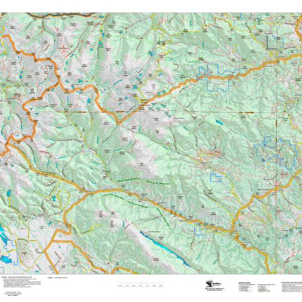
CO Bighorn Custom Unit Topographical Map
The Bighorn Sheep Topo map is a custom built Unit map at 1:60,000, 1:100,000, or 1:120,000 scales depending on the size of the unit. We layer Unit boundaries, public and private land outlines, elevation contours, add the familiar green vegetation shading, then add the roads and trails extracted from the new USGS Quad maps. Regardless of the map scale, it will have all of the roads and trails from the 7.5 minute Quads.
All of this information is printed on our rugged rip and water resistant fabric. This map will last as long as your hunting memories.
Select options
This product has multiple variants. The options may be chosen on the product page