


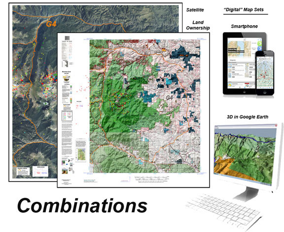
Save with Goat Map Combinations
This combo includes one, two, or 3 printed custom maps with roads and trails extracted from the USGS 7.5 minute Quad maps. The land ownership maps are built using current land ownership data from the BLM identifying private, BLM, National Forest, CPW and other public land parcels. The Land Ownership and Satellite maps have plotted kill sites and drainages with summer and winter concentrations. The kill sites are color coded by year. The Topo Map provides a traditional Topo view with unit boundaries and the shaded green vegetation.
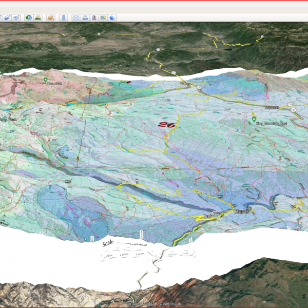
The 3D maps can be opened in Google Earth. The Digital maps (3) are exact copies of the printed maps.
Select options
This product has multiple variants. The options may be chosen on the product page

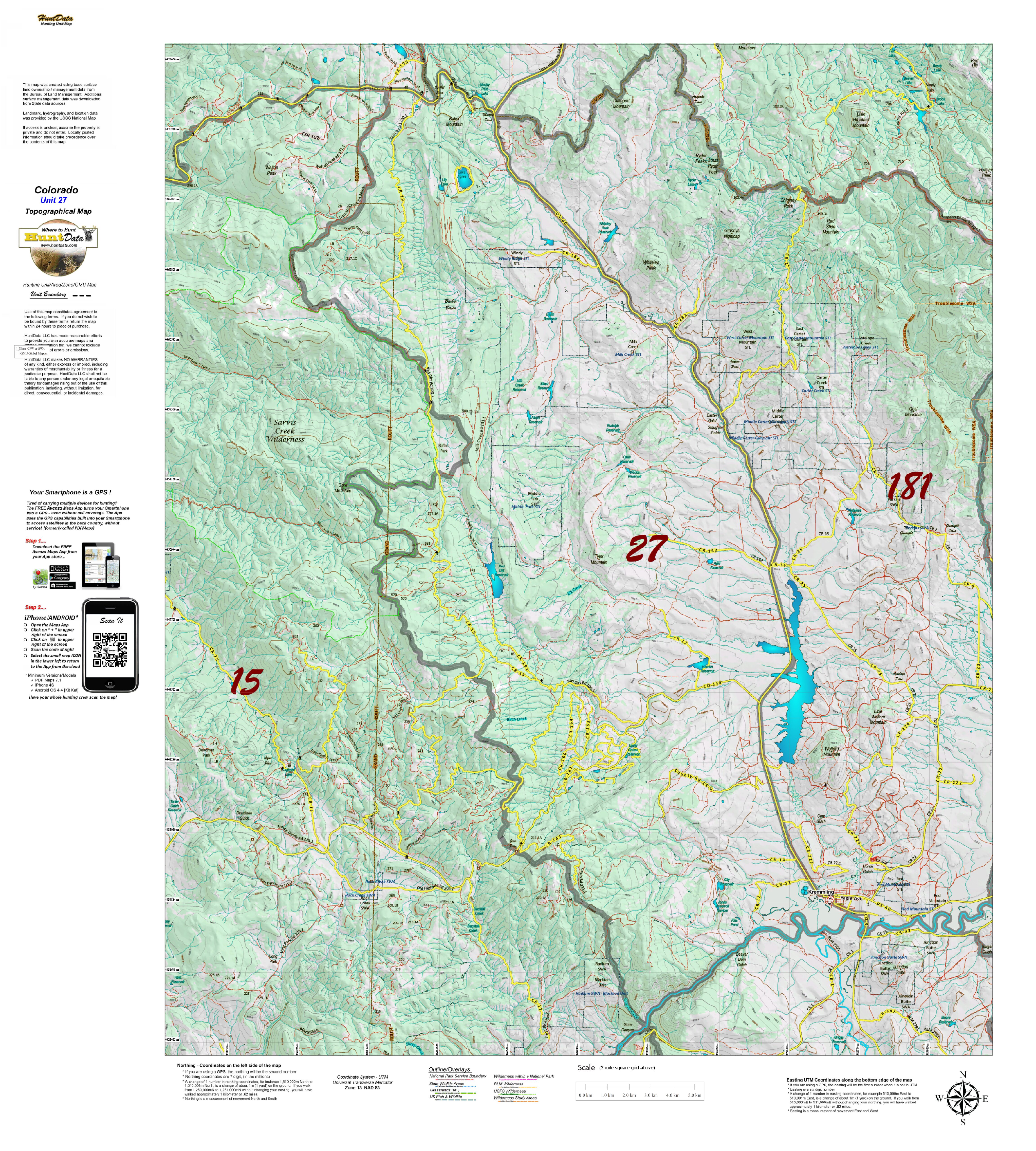
Save with CO Bighorn Sheep 3D and Printed Map Combo’s
This combo includes one, two, or all three printed Land Ownership, Satellite, and Topo Maps combined with the 3D versions of the maps. The maps are printed on our rugged water and tear resistant fabric. The 3D images contain quick scan QR codes for loading into your Smartphone.
Select options
This product has multiple variants. The options may be chosen on the product page
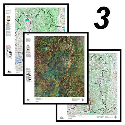
3 Colorado Moose Printed Maps – Land Ownership, Satellite, Topo – Save $30
This combo includes 3 printed custom maps with roads and trails extracted from the USGS 7.5 minute Quad maps.
The land ownership maps are built using current land ownership data from the BLM identifying private, BLM, National Forest, CPW and other public land parcels. The Land Ownership and Satellite maps have plotted kill sites and drainages with summer and winter concentrations. The kill sites are color coded by year. The Topo Map provides a traditional Topo view with unit boundaries and the shaded green vegetation.
Select options
This product has multiple variants. The options may be chosen on the product page
Colorado Combo! 3 Elk Maps plus Digital 3D Maps.
Land Ownership, Elk Concentration, and Topo Map. PLUS, 3D Digital Maps for Google Earth, to study during your Office Scouting! The Land Ownership and Elk Concentration Maps are printed on our rugged fabric material, the 3 Map "Hunting Pack" - Land Ownership and Elk Concentration Maps - are the ideal field guide for your hunting group! Click Here to see the Statewide GMU Reference Map. Check out samples of these maps under the Elk Concentration, Land Ownership and Topo Categories.
Select options
This product has multiple variants. The options may be chosen on the product page
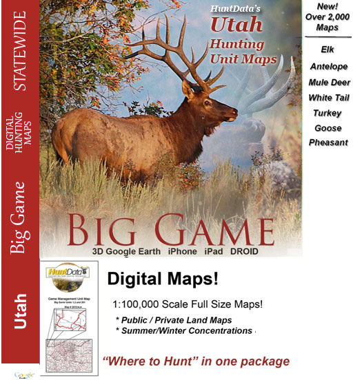
Utah Digital Maps.
Digital Maps for every unit in Utah - use them in 3D in Google Earth or in Avenza Maps App on your iOS, DROID or Windows device!
Select options
This product has multiple variants. The options may be chosen on the product page

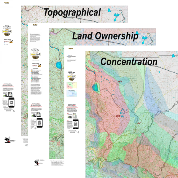
UT Antelope Hunting Pack.
Get all 4 great maps, Land Ownership, Habitat, Satellite and Satellite. The first 3 are printed on our rugged map fabric. The Topo map is printed on our tear and water resistant paper. The ultimate pack of maps for your hunt.
Select options
This product has multiple variants. The options may be chosen on the product page

Utah 4 Map Combo, Save $20.
Get all 4 great maps, Land Ownership, Habitat, Satellite and Topo. The first 3 are printed on our rugged map fabric. The Topo map is printed on our tear and water resistant paper. The ultimate pack of maps for your hunt.
Select options
This product has multiple variants. The options may be chosen on the product page
UT Elk Hunting Pack – Order all 4 maps and save $20.
Get all 4 great maps, Land Ownership, Habitat, Satellite and Topo. The first 3 are printed on our rugged map fabric. The Topo map is printed on our tear and water resistant paper. The ultimate pack of maps for your hunt.
Select options
This product has multiple variants. The options may be chosen on the product page
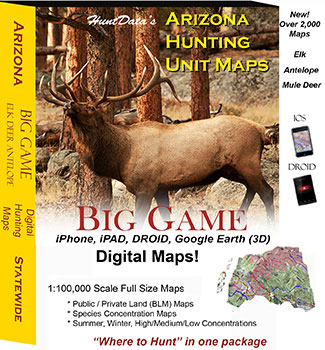
Arizona Digital Maps.
Digital Maps for every unit in Arizona - use them in 3D in Google Earth or in Avenza Maps App on your iOS,DROID or Windows device!
Select options
This product has multiple variants. The options may be chosen on the product page
Digital Maps – Wyoming State Map Set.
A first of its kind. The Statewide Wyoming Map set consists of over 1,100 maps. This includes 3 maps for every Antelope Unit. A Topo map with boundaries, a Land Ownership Map from the BLM, and a first of its kind - a habitat map showing summer range, winter range, and migration routs. View these maps on your desktop or go mobile and load them to your iPhone, iPad, or DROID. A must-have for serious hunters.
Select options
This product has multiple variants. The options may be chosen on the product page
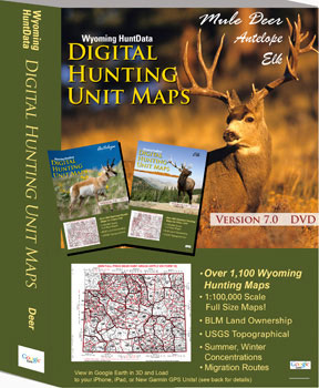
Wyoming Statewide Digital Map Collection.
A first of its kind. The Statewide Wyoming Map set consists of over 1,100 maps. This includes 3 maps for every Deer Unit. A Topo map with boundaries, a Land Ownership Map from the BLM, and a first of its kind - a habitat map showing summer range, winter range, and migration routs. View these maps on your desktop or go mobile and load them to your iPhone, iPad, or DROID. A must-have for serious hunters.
Select options
This product has multiple variants. The options may be chosen on the product page
Wyoming Statewide Digital Map Collection.
A first of its kind. The Statewide Wyoming Map set consists of over 1,100 maps. This includes 3 maps for every elk Unit. A Topo map with boundaries, a Land Ownership Map from the BLM, and a first of its kind - a habitat map showing summer range, winter range, and migration routes. View these maps on your desktop or go mobile and load them to your iPhone, iPad, or DROID. A must-have for serious hunters.
Select options
This product has multiple variants. The options may be chosen on the product page